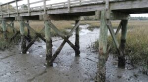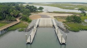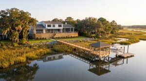
Nearly every structure built on or over the water in coastal South Carolina requires a critical area permit. Docks, piers, boat lifts, bulkheads, seawalls, riprap, boat ramps, marsh crossings and living shorelines all fall inside it. So does a surprising amount of work people assume is routine — replacing an existing bulkhead in a different position, adding a float to a permitted dock, or filling a low spot near a marsh edge.
This is a practical guide to that process: what the critical area is, who administers it now, when you need a permit, what the review actually weighs, and how long it takes.
Who issues these permits now
The programme most people still call “OCRM” — the Office of Ocean and Coastal Resource Management — was part of the South Carolina Department of Health and Environmental Control for decades. Following the state’s 2024 reorganisation, DHEC’s environmental functions moved to the South Carolina Department of Environmental Services (SCDES), and coastal permitting is now administered through its Bureau of Coastal Management.
In practice you will still hear the work described as an “OCRM permit” or a “DHEC permit” throughout the industry, and older reference material uses those names. The rules, the critical-area boundaries and the review standards are substantially the same. The agency letterhead and the submission portal are what changed. Current forms, boundary information and guidance are published by SCDES.
A second approval usually runs alongside the state one: authorisation from the U.S. Army Corps of Engineers, Charleston District, under Section 10 of the Rivers and Harbors Act and Section 404 of the Clean Water Act. Most private residential docks clear this under a general permit that moves in parallel with the state review rather than after it.
What the critical area actually is
South Carolina’s coastal critical area has three components:
- Coastal waters — the navigable tidal waters of the state.
- Tidelands — the marsh: land subject to regular tidal flooding, generally where Spartina and other salt-tolerant vegetation grow.
- Beach and beach/dune system — the oceanfront, with its own separate and stricter rules.
The landward boundary of the tidelands portion is the critical area line, and it is the single most consequential line on a waterfront property. Where it falls determines whether a structure needs a state permit at all, how far a bulkhead may be built, and where a dock’s permitted footprint begins. It is delineated in the field by agency staff, and it is not the same as the property line, the marsh edge you can see, or a FEMA flood boundary.
If you are buying waterfront with a dock in mind, having the critical area line located before closing is among the most useful due diligence available. It has changed the value of more than one transaction we have been asked about.
When you need a permit
| Work | Permit typically required? |
|---|---|
| New private dock, pier or walkway | Yes — state and Corps |
| Adding a float, ramp or lift to a permitted dock | Yes — usually a permit modification |
| New bulkhead or seawall | Yes |
| Replacing a bulkhead in the same alignment | Often yes, sometimes as a maintenance authorisation |
| Riprap or living shoreline | Yes |
| Boat ramp, launch or marina work | Yes — more extensive review |
| Re-decking within an existing permitted footprint | Usually no new permit |
| Replacing damaged pilings in the same positions | Often maintenance; confirm before starting |
| Dredging of any kind | Yes — significantly harder |
The line between “repair” and “new work” is where owners most often get caught. Repairing in kind and in place is generally maintenance. Moving a structure, enlarging it, or rebuilding it in a different alignment is new work and needs authorisation. When in doubt, ask before the barge arrives — unpermitted work in the critical area brings removal orders and penalties, and it complicates every future permit on that property.
What the review weighs
Applications are assessed against a set of considerations that are worth understanding, because they explain why designs get shortened or refused:
Impact on the marsh. Minimising the footprint on vegetated tidelands is the central concern. It drives walkway width limits, the requirement to elevate over marsh rather than fill, and the scrutiny applied to roofs that shade Spartina.
Navigation. A structure may not unreasonably obstruct a waterway. On narrow tidal creeks this is the binding constraint, and it is why the permitted extension of a private dock is limited relative to creek width.
Neighbouring property. Extension lines drawn from adjacent property boundaries limit how far a dock may reach and where a pierhead may sit. Objections from adjacent owners are the largest single cause of delay in the whole process.
Public trust and access. The tidelands are held in trust for the public. Private structures are permitted uses of that resource, not entitlements.
Shellfish beds and habitat. A project over or near a mapped shellfish bed, a designated nursery area or a heron rookery receives closer review and may be relocated or refused.
Cumulative impact. A creek that already carries many docks is assessed differently from one that does not.
The process, step by step
- Site assessment. A low-tide walk establishing depth, distance, creek width and where the critical area line likely falls.
- Survey. A licensed surveyor produces a plat showing boundaries, the critical area line, the proposed structure and neighbouring docks. Lead times run three to six weeks in busy periods.
- Application. Plans, plat, project description, adjacent owner details and fee, submitted to SCDES. The Corps submission runs alongside.
- Completeness review. Two to six weeks. Incomplete applications are returned and restart this stage — the most common avoidable delay in the process.
- Public notice. Typically 30 days, during which adjacent owners and the public may comment.
- Agency review. One to four months, longer where objections, shellfish beds or navigation concerns are present.
- Decision. Approval, approval with conditions, or denial. Conditions are common and frequently involve shortening a structure or shifting its alignment.
Total: three to eight months for a straightforward private dock, and longer where the project is contested or unusual. Commercial, municipal and marina projects routinely run twelve to twenty-four months. The full construction schedule, including everything that happens after the permit, is set out in how long it takes to build a dock in Charleston.
What delays applications, and how to avoid it
- Incomplete submissions. Missing adjacent owner information and inadequate plats account for most returns.
- Neighbour objections. Talk to adjacent owners before you submit. An objection resolved over a fence costs nothing; one resolved through an agency costs months.
- Designing beyond what the site supports. A pierhead sized for the owner’s wish rather than the creek’s width will come back shortened. Design to the constraint first.
- Missing the HOA cycle. Architectural review boards in Kiawah, Seabrook, Daniel Island, Dunes West, Wild Dunes and elsewhere often meet monthly. Submit to them in parallel with the state, not after.
- Changing the design mid-review. Adding a lift or extending the pierhead after submission means amending or resubmitting.
After the permit is issued
Permits carry conditions, and those conditions are enforceable. Common ones include construction windows that avoid spawning or nesting seasons, limits on equipment access across marsh, requirements to remove all construction debris, and as-built certification once the work is complete.
Permits are also valid for a defined term with extension available. There is no need to rush construction, but do not let one lapse — reapplying restarts the entire clock.
Frequently asked questions
Is it still called an OCRM permit?
The programme is now the Bureau of Coastal Management within SCDES, but the industry still uses “OCRM permit” and “DHEC permit” interchangeably for the same authorisation. Any of the three names will be understood.
Do I need a permit to repair my existing dock?
Repair in kind and in place is generally treated as maintenance and does not need a new permit. Rebuilding in a different position, enlarging the structure, or adding components does. Confirm before work starts — see our guide to dock piling repair and replacement.
Can I build a dock on any waterfront lot?
No. Narrow creeks, extensive marsh, proximity to neighbouring docks, shellfish beds and navigation channels can all mean a lot will not support a permitted dock, or will support a much smaller one than the owner expects. Establish this before purchase where possible.
What happens if work is done without a permit?
Enforcement can require removal at the owner’s expense and impose penalties, and the record complicates every subsequent application on the property. It is not a risk worth taking on a structure this visible.
Who prepares the application?
We do, as part of the project — survey coordination, drawings, application, agency correspondence and HOA submissions. Owners should not be chasing agencies for status.
Does a bulkhead or seawall need the same permit?
Yes, and shoreline structures are assessed against their own criteria including erosion history and effect on neighbouring property. See seawall cost in Charleston and living shorelines and erosion control.
Getting it right the first time
Permitting is the longest phase of any waterfront project and the one where inexperience is most expensive. Most of what goes wrong is avoidable: an incomplete file, a design that ignores a constraint, a neighbour who first heard about the project from a public notice.
We have taken projects through this process across the Charleston area for years — residential docks, bulkheads, marina work and municipal infrastructure. If you are planning waterfront construction and want to know what your property will support before you spend anything, get in touch.